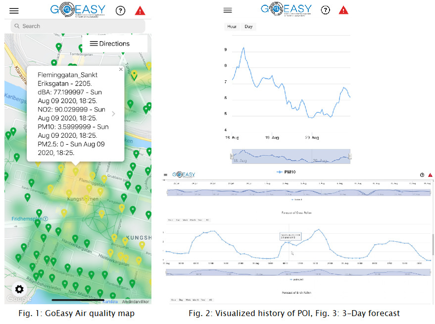
GoEasys AsthmaWatch app combines Galileo satellite positioning data with live air quality monitoring data to offer people with asthma and other lung-related diseases a fine-grained air quality map of their city. As basis of several services of AsthmaWatch like early warnings of areas with low air quality, best route selection regarding pollution, current and historic pollution rendering at specific points of interest, aiming at improving life quality for people with asthma and other lung-related diseases.
The GoEasy data collection platform was extended to include data from the Copernicus Atmosphere Monitoring Service (CAMS). CAMS is one of six services of Copernicus, the European Union’s Earth observation programme, which is based on a set of satellites and ground-based observation stations. Data from CAMS is available as Gridded Binary (GRIB) files, a standard used in meteorology. It provides weather data up to three days into the future. In GoEasy we have developed advanced translation software to translate GRIB data into a JSON-based format like OGC (Open Geospatial Consortium) so that the complex GRIB format can easily be integrated and used in any IoT application. The AsthmaWatch smartphone app already showed the current level of different pollutants and visualized historical readings at a certain point-of-interest. Now it has been extended to also provide users with an instant 3-day forecast, including 8 different pollens, 5 pollutants, solar radiation and temperature.